


|
Real Estate Links |
Official City Links. Links to Zoning, Codes, Schools and Demographics (A - |
|
|
American Fork, in northern Utah County, is located 15 miles northwest of Provo and 30 miles south of Salt Lake City. It is bordered by Utah Lake on the south and by the Wasatch Mountains to the east. Adjacent to it lies the communities of Highland, Cedar Hills and Pleasant Grove to the east, Lehi to the west and Highland and Alpine to the north. American Fork’s unique old world charm, with a mixture of modern development, is a great place to locate a business or raise a family. Discovered by fur trappers and settled by Mormon pioneers, this historic town has become Utah’s fifteenth largest city. Conveniently situated just off Interstate 15 between Provo and Salt Lake City, it is an ideal location for commuters, families, and businesses. |
|
Alpine City is located in the northern part of Utah County just at the base of the ..... mountain range. Alpine was incorporated in 1850 and started out as a farming community. The current census information states that Alpine has a population of 9,555 with 2,529 homes. |
|
|
Bluffdale City was incorporated as a municipality in 1978 and is located at the south end of Salt Lake County. The current population of the city is approximately 8200. The community is characterized by large lot development with animal rights and is a major crossroads for transportation and utilities between Salt Lake and Utah Counties. Bluffdale City is also home to one of the longest sections of the Jordan River corridor. |
|
|
Bountiful is a city in Davis County, Utah, United States. As of the 2010 census, the city population was 42,552, a three percent increase over the 2000 figure of 41,301. The city grew rapidly during the suburb growth of the late 1940s, 1950s, and 1960s and is currently Utah's 15th largest city. Although a part of the Ogden- |
|
|
Cottonwood Heights is a city located in Salt Lake County, Utah, United States, along the east bench of the Salt Lake Valley. It lies south of the cities of Holladay and Murray, east of Midvale, and north of Sandy within the Salt Lake City, Utah Metropolitan Statistical Area. Following a successful incorporation referendum in May 2004, the city was incorporated on January 14, 2005. Cottonwood Heights had been a Census- As the city's name suggests, its geography is dominated by a high ridge separating the valleys of the Big and Little Cottonwood Creeks. At the eastern edge of the city, these valleys narrow into the Big and Little Cottonwood Canyons within the Wasatch Mountains, respectively; this is reflected by the city's official nickname, "City between the canyons". The ridge is covered in suburban housing, but most commercial development has been restricted to the lower- State Route 190 and State Route 210 run near the eastern edge of the city and provide access to the canyons; they are the only state routes that enter the city. Interstate 215 runs along the northern border of the city and State Route 152 touches the city at a point. The city is building a multi- Cottonwood Heights is in the Canyons School District; Brighton High School is the only public high school in the city. Butler Middle school is the only middle school in city limits. |
|
|
Draper is a city in Salt Lake and Utah counties in the U.S. state of Utah, located about 20 miles (32 km) south of Salt Lake City along the Wasatch Front. As of the 2010 census, it had a population of 42,274,[1] having grown from 7,143 in 1990. Draper is part of two metropolitan areas - The Utah State Prison is located in Draper, near Point of the Mountain, alongside Interstate 15. Draper lies roughly midway between Salt Lake City and Provo. Draper is bordered by Riverton and Bluffdale to the west, South Jordan to the northwest, Sandy to the north, Alpine to the southeast, Highland to the south, and Lehi to the southwest. According to the United States Census Bureau, the city has a total area of 30.1 square miles (78.0 km2), of which 30.1 square miles (77.9 km2) is land and 0.015 square miles (0.04 km2), or 0.05%, is water.[2] The winds on Traverse Ridge make it a popular area for hang gliding and paragliding. In 2004, Draper citizens voted for a tax increase that would pay for the purchase of key pieces of property in the Corner Canyon area. The aim of this measure was to protect and preserve the Corner Canyon area for the future enjoyment of citizens of the city and the Salt Lake Valley area. In the fall of 2005, 1,021 acres (4.13 km2) of property were identified and purchased for the development of Corner Canyon Regional Park, which will consist of parks, trails, and other recreation areas. |
|
|
Eagle Mountain City is a master- Eagle Mountain sits just 40 miles southwest of Salt Lake City and 30 miles northwest of Provo, Utah at the western base of the Lake Mountains. The historic Pony Express Trail runs though the city. Since its incorporation in December 1996, the city’s population has grown from 250 residents to more than 24,000, becoming one of the state’s fastest growing communities. We are the third largest city geographically in the state of Utah. Eagle Mountain residents enjoy quiet, safe neighborhoods with plenty of open space where families can play and spend time together. The city’s master plan includes more than 30 miles of jogging, bike, and horse trails, connecting Eagle Mountain’s residential developments. In a 2011 citizen satisfaction survey, more than 93% of residents rated their quality of life as “good” or “excellent.” |
|
|
Highland is located in north Utah. Highland is part of Utah County. Highland has 8.52 square miles of land area and has no water area. As of 2010, the total Highland population is 15,523, which has grown 89.95% since 2000. The population growth rate is much higher than the state average rate of 23.77% and is much higher than the national average rate of 9.71%. Highland median household income is $99,516 in 2008- |
|
|
City of Holladay On July 29, 1847 a group of pioneers known as the Mississippi Company, led by John Holladay, entered the Salt Lake Valley. Within weeks after their arrival, they discovered a free flowing, spring fed stream, which they called Spring Creek (near Kentucky Avenue). While most of the group returned to the Fort in Great Salt Lake for the winter, two or three men built dugouts along this stream and wintered over. Thus, this became the first village established away from Great Salt Lake City itself. In the spring, a number of families hurried out to build homes and tame the land. There were numerous springs and ponds here and grasses and wild flowers were abundant, making this a most desirable area for settlement. When John Holladay was named as the branch president of the Church, the village took upon itself the name of Holladay’s Settlement or Holladay’s Burgh. As homes were built, commercial ventures developed, first at the intersection of Highland Drive and Murray- The Holladay and Cottonwood communities were unincorporated areas of Salt Lake County and 15 years ago efforts were made by a dedicated group of citizens to incorporate as a separate entity, but area citizens voted against incorporation by a narrow margin. Salt Lake County, the Utah Supreme Court and/or the Utah State Legislature frustrated subsequent efforts and citizens weren’t allowed another incorporation vote until May 4, 1999. On that day, a better- Residents overwhelmingly supported incorporation because of a profound desire to gain control of local planning and zoning. General Plan meetings were attended by a large number of enthusiastic Holladay residents, all excited to finally have a voice in the future of our community. A vast majority – if not all – of those attending wanted Holladay to maintain and even improve its rural atmosphere. Suggestions included: Make the central Holladay business area more pedestrian friendly Create biking and walking trails through the community Curtail downsizing of building lots Preserve and increase trees and other vegetation Require large parking areas to include landscaping Subsequently an area north and east of the original boundaries of Holladay were annexed into the City in October of 2002. |
|
|
Herriman is a city in southwestern Salt Lake County, Utah, United States. The population was 21,785 as of the 2010 census. Although Herriman was a town in 2000,[1] it has since been classified as a fifth- |
|
|
Utah's Hometown ~ Baseball, hot dogs and apple pie - We're uniquely situated and conveniently located "in the middle of everything." Kaysville isn't just a great place to live, it's a great place to do business. Great accessibility and low taxes are just some of the benefits our businesses enjoy. It's obvious why Kaysville has become Utah's Hometown. |
|
|
Kearns is a census- The Utah Olympic Oval in Kearns was the venue for long- Demographics As of the census of 2000, there were 33,659 people, 9,203 households, and 7,932 families residing in the CDP. The population density was 2,701.8/km² (6,994.1/mi²). There were 9,413 housing units at an average density of 755.6/km² (1,956.0/mi²). The racial makeup of the CDP was 81.78% White, 0.66% African American, 1.02% Native American, 1.69% Asian, 2.34% Pacific Islander, 9.82% from other races, and 2.70% from two or more races. Hispanic or Latino of any race were 19.62% of the population. There were 9,203 households out of which 54.1% had children under the age of 18 living with them, 67.3% were married couples living together, 13.1% had a female householder with no husband present, and 13.8% were non- In the CDP the population was spread out with 37.2% under the age of 18, 11.2% from 18 to 24, 32.0% from 25 to 44, 13.4% from 45 to 64, and 6.3% who were 65 years of age or older. The median age was 26 years. For every 100 females there were 102.5 males. For every 100 females age 18 and over, there were 100.2 males. The median income for a household in the CDP was $45,711, and the median income for a family was $46,598. Males had a median income of $31,444 versus $22,838 for females. The per capita income for the CDP was $14,110. About 5.1% of families and 7.1% of the population were below the poverty line, including 9.3% of those under age 18 and 6.5% of those age 65 or over. |
|
|
Lehi, Utah, is located 12 miles north of Provo and 23 miles south of Salt Lake City. Lehi was originally settled by the Mormon Pioneers in 1850. Historical names for the City have included: Sulphur Springs, Snow’s Springs, Dry Creek, and Evansville. The City’s name was changed to Lehi City and incorporated 1852. Lehi is named after a Book of Mormon Hebrew prophet who led his followers to the promised land in the western hemisphere [c. 600 B.C.]. It is Utah’s sixth oldest town, and the northernmost community in Utah Valley. Lehi experienced monetary boom in 1858 as a result of the establishment of the Utah Expeditionary Force at nearby Camp Floyd, the largest military establishment in the United States, at that time. The local economy skyrocketed again in the 1890s with the establishment of the Utah Sugar Company’s first factory at Mulliner’s Mill Pond. The Overland Stage Coach Route, Pony Express Trail, and Transcontinental Telegraph all crossed the Jordan River at nearby Indian Ford. Lehi City municipal offices are housed in new facilities. The city also boasts a new public library, senior citizens complex, and public safety building. In addition to one of the finest culinary water systems in the state (a $3.74- “Lehi is a good place to live,” has been the community’s official slogan since 1911. In addition to a safe, quiet, family- |
|
|
Magna is a census- |
|
|
Midvale is a city in Salt Lake County, Utah, United States. It is part of the Salt Lake City, Utah Metropolitan Statistical Area. The population was 27,964 at the 2010 census. Just like the wandering Ute bands before them, Utah's Pioneer settlers began with a dependence on the land and the landscape; thus, early pioneers were quick to recognize the richness inherent in the Salt Lake Valley. They saw the abundant creeks and the grassy valley and envisioned farmlands and fields. They discovered the minerals and ores that envisioned thriving communities of commerce and industry. They came to stay, and their mark was soon upon the landscape. Such was the beginning of Midvale City. The eastern part of the city forming agricultural neighborhoods, and the western areas forming a mining and milling settlement, each relying on the other for sustenance, protection, social interaction and commerce. The Union Fort area of Midvale City began as a center of agriculture. The Old Town area of Midvale City began as a center of mining and industry. Pioneer families began arriving in 1851 to start the settlement, which blossomed in the 1870s as a result of mining in Bingham Canyon and the coming of the railroad. The area was then known as Bingham Junction, and was an important midpoint along the rail between mining in Little Cottonwood Canyon to the east and Bingham Canyon to the west. With the discovery of silver in Little Cottonwood Canyon and in Bingham Canyon, new people rushed to be a part of the growing business and industry located in the middle valley in Midvale City. Along with industry came the hotels, boarding houses, saloons, schools, and the people who made Midvale City's Old Town a center of the community. Some scenes from the mini- |
|
|
Murray is a city situated on the Wasatch Front in the core of Salt Lake Valley in the U.S. state of Utah. Named for territorial governor Eli Murray, it is the state's fourteenth largest city. According to the 2010 census, Murray has approximately 46,746 residents. Murray is close to Salt Lake City, West Valley City, Sandy and West Jordan, Utah. Once teeming with heavy industry, Murray’s industrial sector now has little trace and has been replaced by major mercantile sectors. Known for its central location in Salt Lake County, Murray has been called the Hub of Salt Lake County. Murray is unlike most of its neighboring communities as it operates its own police, fire, power, water, library, and parks and recreation departments and has its own school district. While maintaining many of its own services, Murray has one of the lowest city tax rates in the state. Thousands of people each year visit Murray City Park for organized sports and its wooded areas. Murray is home to the Intermountain Medical Center, a huge medical campus that is also Murray’s largest employer. Murray has been designated a Tree City USA since 1977. According to the United States Census Bureau, the city has a total area of 9.6 square miles (24.9 km²), all of it land. Murray is located in the heart of the Salt Lake Valley. The city is nearly built out with a broad mix of commercial, residential and industrial uses. The topography is generally gentle, sloping westward from the nearby Wasatch Mountain Range toward the Jordan River, which is the terminal river feature in the Salt Lake Valley. Murray’s average altitude is approximately 1300 meters Above Sea Level, with the highest variation located near the border of Cottonwood Heights and lowest variation along the Jordan River near 4500 South Street. Lying at the base of the Wasatch Mountains, and located approximately three miles to the east of Murray, in neighboring Holladay, is the Wasatch Fault. Liquefaction is a particular danger to Murray because of the close proximity of the Wasatch fault. Soil liquefaction potential, according to the Utah Geological Survey, estimates that the majority of Murray City is in either High or Moderate Liquefaction zones. City policies are in place to minimize the potential impacts on structures |
|
|
The city of North Salt Lake. As of the census of 2000, there were 8,749 people, 2,874 households, and 2,253 families residing in the city. The population density was 1,060.7 people per square mile (409.5/km²). There were 3,022 housing units at an average density of 366.4 per square mile (141.4/km²). The racial makeup of the city was 92.60% White, 0.31% African American, 1.01% Native American, 1.50% Asian, 0.42% Pacific Islander, 2.40% from other races, and 1.76% from two or more races. Hispanic or Latino of any race were 6.36% of the population. There were 2,874 households out of which 42.6% had children under the age of 18 living with them, 64.3% were married couples living together, 9.4% had a female householder with no husband present, and 21.6% were non- In the city the age distribution of the population shows 31.9% under the age of 18, 13.0% from 18 to 24, 29.2% from 25 to 44, 18.1% from 45 to 64, and 7.7% who were 65 years of age or older. The median age was 28 years. For every 100 females there were 102.1 males. For every 100 females age 18 and over, there were 99.4 males. The median income for a household in the city was $47,052, and the median income for a family was $52,485. Males had a median income of $40,101 versus $26,223 for females. The per capita income for the city was $21,544. About 3.0% of families and 3.3% of the population were below the poverty line, including 3.6% of those under age 18 and 2.3% of those age 65 or over. |
|
|
Park City is a city in Summit County, Utah, United States. It is considered to be part of the Wasatch Back. The city is 32 miles (51 km) southeast of downtown Salt Lake City and 19.88 miles (31.99 km) from Salt Lake City's east edge of Sugar House along Interstate 80. The population was 7,558 at the 2010 census. On average, the tourist population greatly exceeds the number of permanent residents. After a population decline following the shutdown of the area's mining industry, the city rebounded during the 1980s and 1990s through an expansion of its tourism business. The city currently brings in a yearly average of $529,800,000 to the Utah Economy as a tourist hot spot. The city has three major ski resorts: Canyons Resort, Deer Valley Resort, and Park City Mountain Resort. The Park City and Deer Valley ski resorts were the major locations for ski and snowboarding events at the 2002 Winter Olympics. Although they receive less snow and have a shorter ski season than do their counterparts in Salt Lake County, such as Snowbird resort, they are much easier to access. Additionally the city is the main location of the United States' largest independent film festival, the Sundance Film Festival, home of the United States Ski Team, training center for members of the Australian Freestyle Ski Team, the largest collection of factory outlet stores in northern Utah, the 2002 Olympic bobsled/skeleton/luge track at the Utah Olympic Park, and golf courses. Some scenes from 1994's Dumb and Dumber were shot in the city. Outdoor- In the summertime many valley residents of the Wasatch Front visit the town to escape high temperatures. Park City is usually 20 °F (11 °C) cooler than Salt Lake City,[citation needed] as it lies mostly above 7,000 feet (2,100 m) above sea level, while Salt Lake City is situated at an altitude of about 4,300 feet (1,300 m). It is one of the wealthiest cities in the United States and is notable for having a large number of Northern and Central European immigrants. In 2008, Park City was named by Forbes Traveler Magazine among one of the 20 'prettiest towns' in the United States. In 2011, the town was awarded a Gold- |
|
|
Riverton is a city in Salt Lake County, Utah, United States. It is part of the Salt Lake City, Utah Metropolitan Statistical Area. The population was 38,753 at the 2010 census. Riverton is one of the fastest- Riverton shares city borders with South Jordan to the north, Draper to the east, Bluffdale to the south, and Herriman to the west. According to the United States Census Bureau, the city has a total area of 12.6 square miles (32.6 km²). The city is located in the Southwestern corner of the Salt Lake Valley about twenty miles (32 km) south and slightly west of Salt Lake City. Riverton City receives an average of 15.76 inches (400 mm) in precipitation each year. Snow can be seen in the winter, while during the summer temperatures occasionally break 100 °F (38 °C). Riverton has grown rapidly in the last few years, when transforming it from a rural farming town into a suburban city. Businesses, housing, and roads have replaced many of the farms and cattle ranges. |
|
|
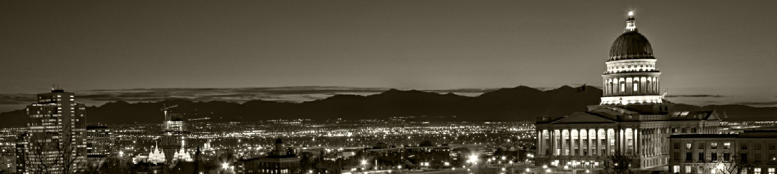
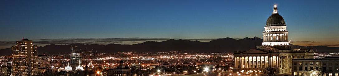
Salt Lake City, often shortened to Salt Lake, or SLC is the capital and the most populous city in the state of Utah. With an estimated population of 189,314 in 2012, the city lies in the core of the Salt Lake City metropolitan area, which has a total population of 1,175,905. Salt Lake City is further situated in a larger urban area known as the Wasatch Front, which has a population of 2,350,274. It is one of only two major urban areas in the Great Basin (the other being Reno, Nevada), and the largest in the Intermountain West. The city was founded in 1847 by Brigham Young, Isaac Morley, George Washington Bradley and several other Mormon followers, who extensively irrigated and cultivated the arid valley. Due to its proximity to the Great Salt Lake, the city was originally named "Great Salt Lake City"—the word "great" was dropped from the official name in 1868 by the 17th Utah Territorial Legislature. Although Salt Lake City is still home to the headquarters of The Church of Jesus Christ of Latter- Immigration of international LDS members, mining booms, and the construction of the first transcontinental railroad initially brought economic growth, and the city was nicknamed the Crossroads of the West. It was traversed by the Lincoln Highway, the first transcontinental highway, in 1913, and presently two major cross- |
|
|
Sandy |
Sandy City is home to the South Towne Center shopping mall, the Jordan Commons entertainment and dining complex, and the Southtowne Exposition Center. It is also the location of the soccer- |
|
South Jordan |
South Jordan is a city in the U.S. state of Utah. The city lies in the Salt Lake Valley between the 9,000- The city was founded 18 miles south of Salt Lake City along the banks of the Jordan River in 1859 by Mormon settlers. An agrarian town for most of its history, today it is a rapidly growing bedroom community of Salt Lake City. Kennecott Land, a land development company, has recently begun construction on the master- The city has 27 municipal parks and playgrounds ranging in size from 0.39- Two trails meander through South Jordan. The Bingham Creek Trail starts in the northwest part of the city and travels 0.5 miles North- Salt Lake County operates the 120- The 67- Privately owned, but open to the public, Glenmoor Golf course is inside city limits. Salt Lake County- |
|
Taylorsville is a city in Salt Lake County, Utah, United States. It is part of the Salt Lake City, Utah Metropolitan Statistical Area. The population was 58,657 at the 2010 census. Taylorsville was incorporated from the Taylorsville- The area called Taylorsville today is made up of three historic communities in the central part of Salt Lake County: Taylorsville, Bennion, and Kearns. These communities incorporated through a vote of the people with over 70 percent approval in September 1995. The city officially became the City of Taylorsville during the centennial anniversary of Utah's statehood in 1996. The land on which Taylorsville is located is part of an interconnected alluvial plain that was formed by the wearing down of the Wasatch and Oquirrh Mountains to the east and west. Beneath the surface Taylorsville sits on more than a kilometer of unconsolidated rock, sand, and clay. The inactive Taylorsville Fault has been traced down the center of the Salt Lake Valley. Lake Bonneville shaped the topography of the area and deposited lake bottom clay and sand. As Lake Bonneville dried up over the past 14,000 years, the salt from the breakdown of rock remains, making the soil alkaline. Like most desert soils, it has little organic material and is hard to work. A broad, east- |
|
|
|
Source http://en.wikipedia.org/ |
|
|
|
|
|
|